Fortran module for sfcpcorrected observation operator. More...
Data Types | |
| type | ufo_sfcpcorrected |
| Fortran derived type for the observation type. More... | |
Functions/Subroutines | |
| subroutine | ufo_sfcpcorrected_setup (self, f_conf) |
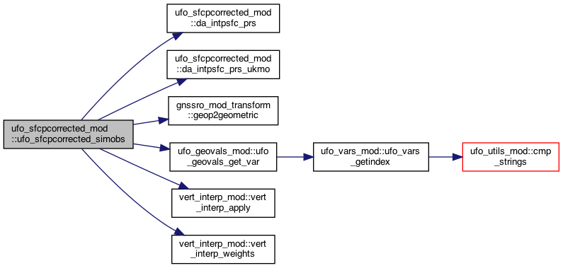
| subroutine | ufo_sfcpcorrected_simobs (self, geovals, obss, nvars, nlocs, hofx) |
| subroutine | da_intpsfc_prs (nobs, missing, P_o2m, H_o, P_o, H_m, TV_m, T_o, Q_o) |
| \Conduct terrain height correction for surface pressure More... | |
| subroutine | da_intpsfc_prs_ukmo (nobs, missing, P_o2m, H_o, P_o, H_m, P_m, TV_2000, P_2000) |
| \Conduct terrain height correction for surface pressure More... | |
Variables | |
| integer, parameter | max_string = 800 |
| character(len=maxvarlen), dimension(5) | geovars_list = (/ var_ps, var_geomz, var_sfc_geomz, var_tv, var_prs /) |
Detailed Description
Fortran module for sfcpcorrected observation operator.
Function/Subroutine Documentation
◆ da_intpsfc_prs()
| subroutine ufo_sfcpcorrected_mod::da_intpsfc_prs | ( | integer, intent(in) | nobs, |
| real(c_double), intent(in) | missing, | ||
| real(kind_real), dimension(nobs), intent(out) | P_o2m, | ||
| real(kind_real), dimension(nobs), intent(in) | H_o, | ||
| real(kind_real), dimension(nobs), intent(in) | P_o, | ||
| real(kind_real), dimension(nobs), intent(in) | H_m, | ||
| real(kind_real), dimension(nobs), intent(in) | TV_m, | ||
| real(kind_real), dimension(nobs), intent(in), optional | T_o, | ||
| real(kind_real), dimension(nobs), intent(in), optional | Q_o | ||
| ) |
\Conduct terrain height correction for surface pressure
\This subroutine is based on a subroutine from WRFDA da_intpsfc_prs.inc file corresponding to sfc_assi_options = 1 in WRFDA's namelist
\Date: June 2019: Created \Method: hydrosatic equation
P_o2m = P_o * exp [-grav/rd * (H_m-H_o) / (TV_m + TV_o)/2)
Where: H_m = model surface height H_o = station height TV_m = virtual temperature at model surface height TV_o = virtual temperature at station height P_o2m = pressure interpolated from station height to model surface height P_o = pressure at station height grav = gravitational acceleration rd = gas constant per mole
- Parameters
-
[in] nobs total observation number [out] p_o2m observed PS at model sfc height [in] p_o observed Height and PS [in] tv_m model sfc height and TV [in] q_o obserbed T and Q
Definition at line 313 of file ufo_sfcpcorrected_mod.F90.
◆ da_intpsfc_prs_ukmo()
|
private |
\Conduct terrain height correction for surface pressure
\Reference: Ingleby,2013. UKMO Technical Report No: 582. Appendix 1.
\Method: integrate the hydrosatic equation dp/dz=-rho*g/RT to get P_m2o first, equation:
(P_m2o/P_m)=(T_m2o/T_m)** (grav/rd*L)
Where: P_m2o = model surface pressure at station height P_m = model surface pressure T_m = temperature at model surface height; derived from TV_2000 T_m2o = model surface temperature at station height grav = gravitational acceleration rd = gas constant per mole Lclr = constant lapse rate (0.0065 K/m)
To avoid dirunal/local variations, use TV_2000 (2000 m above the model surface height) instead of direct T_m
T_m = TV_2000 * (P_o / P_2000) ** (rd*L/grav)
Where: P_2000 = background pressure at 2000 m TV_2000 = background virtual temperature at 2000 m P_o = pressure at station height
Finally, in practice, adjust P_o to the model surface height using
P_o2m = P_o * (P_m / P_m2o)
- Parameters
-
[in] nobs total observation number [out] p_o2m observed PS at model sfc height [in] p_o observed Height and PS [in] p_2000 model Height, PS, TV at 2000 m, and P at 2000 m
Definition at line 379 of file ufo_sfcpcorrected_mod.F90.
◆ ufo_sfcpcorrected_setup()
|
private |
In the case where a user wants to specify the geoVaLs variable name of model height of vertical levels and/or the surface height. Example: MPAS is height but FV-3 uses geopotential_height.
Definition at line 40 of file ufo_sfcpcorrected_mod.F90.
◆ ufo_sfcpcorrected_simobs()
| subroutine ufo_sfcpcorrected_mod::ufo_sfcpcorrected_simobs | ( | class(ufo_sfcpcorrected), intent(in) | self, |
| type(ufo_geovals), intent(in) | geovals, | ||
| type(c_ptr), intent(in), value | obss, | ||
| integer, intent(in) | nvars, | ||
| integer, intent(in) | nlocs, | ||
| real(c_double), dimension(nvars, nlocs), intent(inout) | hofx | ||
| ) |
Variable Documentation
◆ geovars_list
| character(len=maxvarlen), dimension(5) ufo_sfcpcorrected_mod::geovars_list = (/ var_ps, var_geomz, var_sfc_geomz, var_tv, var_prs /) |
Definition at line 35 of file ufo_sfcpcorrected_mod.F90.
◆ max_string
|
private |
Definition at line 20 of file ufo_sfcpcorrected_mod.F90.