Geometry data structure. More...
Public Member Functions | |
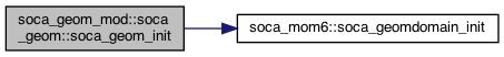
| procedure | init => soca_geom_init |
| Setup geometry object. More... | |
| procedure | end => soca_geom_end |
| Geometry destructor. More... | |
| procedure | set_atlas_lonlat => soca_geom_set_atlas_lonlat |
| Set ATLAS lonlat fieldset. More... | |
| procedure | fill_atlas_fieldset => soca_geom_fill_atlas_fieldset |
| Fill ATLAS fieldset. More... | |
| procedure | clone => soca_geom_clone |
| Clone, self = other. More... | |
| procedure | gridgen => soca_geom_gridgen |
| Generate the grid with the help of mom6, and save it to a file for use later. More... | |
| procedure | thickness2depth => soca_geom_thickness2depth |
| Get layer depth from layer thicknesses. More... | |
| procedure | struct2atlas => soca_geom_struct2atlas |
| Copy a structured field into an ATLAS fieldset. More... | |
| procedure | atlas2struct => soca_geom_atlas2struct |
| Copy a structured field from an ATLAS fieldset. \ see soca_geom_atlas2struct More... | |
| procedure | write => soca_geom_write |
| Write geometry to file. More... | |
Public Attributes | |
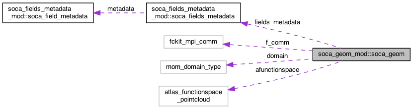
| type(mom_domain_type), pointer | domain |
| Ocean model domain. More... | |
| integer | nzo |
| integer | nzo_zstar |
| type(soca_fields_metadata) | fields_metadata |
| instance of the metadata that is read in from a config file upon initialization More... | |
| character(len=:), allocatable | geom_grid_file |
| filename of geometry More... | |
| type(fckit_mpi_comm) | f_comm |
| MPI communicator. More... | |
| type(atlas_functionspace_pointcloud) | afunctionspace |
| atlas stuff More... | |
local domain indices | |
| integer | isc |
| integer | iec |
| integer | jsc |
| integer | jec |
data domain indices | |
| integer | isd |
| integer | ied |
| integer | jsd |
| integer | jed |
global domain indices | |
| integer | isg |
| integer | ieg |
| integer | jsg |
| integer | jeg |
local compute domain indices | |
| integer | iscl |
| integer | iecl |
| integer | jscl |
| integer | jecl |
local data domain indices | |
| integer | isdl |
| integer | iedl |
| integer | jsdl |
| integer | jedl |
grid latitude/longitude | |
| real(kind=kind_real), dimension(:), allocatable | lonh |
| cell center nominal longitude More... | |
| real(kind=kind_real), dimension(:), allocatable | lath |
| cell center nominal latitude More... | |
| real(kind=kind_real), dimension(:), allocatable | lonq |
| cell corner nominal longitude More... | |
| real(kind=kind_real), dimension(:), allocatable | latq |
| cell corner nominal latitude More... | |
| real(kind=kind_real), dimension(:,:), allocatable | lon |
| Tracer grid longitude. More... | |
| real(kind=kind_real), dimension(:,:), allocatable | lat |
| Tracer grid latitude. More... | |
| real(kind=kind_real), dimension(:,:), allocatable | lonu |
| U grid longitude. More... | |
| real(kind=kind_real), dimension(:,:), allocatable | latu |
| U grid latitude. More... | |
| real(kind=kind_real), dimension(:,:), allocatable | lonv |
| V grid longitude. More... | |
| real(kind=kind_real), dimension(:,:), allocatable | latv |
| V grid latitude. More... | |
ocean/land masks | |
| real(kind=kind_real), dimension(:,:), allocatable | mask2d |
| mask for tracer grid. 0 = land 1 = ocean More... | |
| real(kind=kind_real), dimension(:,:), allocatable | mask2du |
| mask for U grid. 0 = land 1 = ocean More... | |
| real(kind=kind_real), dimension(:,:), allocatable | mask2dv |
| mask for V grid. 0 = land 1 = ocean More... | |
other grid properties | |
| real(kind=kind_real), dimension(:,:), allocatable | sin_rot |
| sine of rotation between logical grid north More... | |
| real(kind=kind_real), dimension(:,:), allocatable | cos_rot |
| cosine of rotation between logical grid north More... | |
| real(kind=kind_real), dimension(:,:), allocatable | cell_area |
| cell area (m^2) More... | |
| real(kind=kind_real), dimension(:,:), allocatable | rossby_radius |
| rossby radius (m) at the gridpoint More... | |
| real(kind=kind_real), dimension(:,:), allocatable | distance_from_coast |
| distance to closest land grid point (m) More... | |
| real(kind=kind_real), dimension(:,:,:), allocatable | h |
| layer thickness (m) More... | |
| real(kind=kind_real), dimension(:,:,:), allocatable | h_zstar |
Private Attributes | |
| logical, private | save_local_domain = .false. |
| If true, save the local geometry for each pe. More... | |
Related Functions | |
(Note that these are not member functions.) | |
| subroutine | soca_geom_init (self, f_conf, f_comm) |
| Setup geometry object. More... | |
| subroutine | soca_geom_end (self) |
| Geometry destructor. More... | |
| subroutine | soca_geom_set_atlas_lonlat (self, afieldset) |
| Set ATLAS lonlat fieldset. More... | |
| subroutine | soca_geom_fill_atlas_fieldset (self, afieldset) |
| Fill ATLAS fieldset. More... | |
| subroutine | soca_geom_clone (self, other) |
| Clone, self = other. More... | |
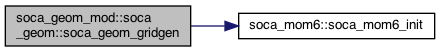
| subroutine | soca_geom_gridgen (self) |
| Generate the grid with the help of mom6, and save it to a file for use later. More... | |
| subroutine | soca_geom_allocate (self) |
| Allocate memory and point to mom6 data structure. More... | |
| subroutine | soca_geom_distance_from_coast (self) |
| Calcuate distance from coast for the ocean points. More... | |
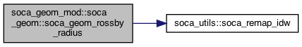
| subroutine | soca_geom_rossby_radius (self) |
| Read and store Rossby Radius of deformation. More... | |
| subroutine | soca_geom_write (self) |
| Write geometry to file. More... | |
| subroutine | soca_geom_read (self) |
| Read geometry from file. More... | |
| subroutine | soca_geom_get_domain_indices (self, domain_type, is, ie, js, je, local) |
| Get indices for compute or data domain. More... | |
| subroutine | soca_geom_thickness2depth (self, h, z) |
| Get layer depth from layer thicknesses. More... | |
| subroutine | soca_geom_struct2atlas (self, dx_struct, dx_atlas) |
| Copy a structured field into an ATLAS fieldset. More... | |
| subroutine | soca_geom_atlas2struct (self, dx_struct, dx_atlas) |
| Copy a structured field from an ATLAS fieldset. More... | |
Detailed Description
Geometry data structure.
Definition at line 43 of file soca_geom_mod.F90.
Member Function/Subroutine Documentation
◆ atlas2struct()
| procedure soca_geom_mod::soca_geom::atlas2struct |
Copy a structured field from an ATLAS fieldset. \ see soca_geom_atlas2struct
Definition at line 145 of file soca_geom_mod.F90.
◆ clone()
| procedure soca_geom_mod::soca_geom::clone |
◆ end()
| procedure soca_geom_mod::soca_geom::end |
◆ fill_atlas_fieldset()
| procedure soca_geom_mod::soca_geom::fill_atlas_fieldset |
Fill ATLAS fieldset.
- See also
- soca_geom_fill_atlas_fieldset
Definition at line 130 of file soca_geom_mod.F90.
◆ gridgen()
| procedure soca_geom_mod::soca_geom::gridgen |
Generate the grid with the help of mom6, and save it to a file for use later.
- See also
- soca_geom_gridgen
Definition at line 136 of file soca_geom_mod.F90.
◆ init()
| procedure soca_geom_mod::soca_geom::init |
◆ set_atlas_lonlat()
| procedure soca_geom_mod::soca_geom::set_atlas_lonlat |
Set ATLAS lonlat fieldset.
- See also
- soca_geom_set_atlas_lonlat
Definition at line 127 of file soca_geom_mod.F90.
◆ struct2atlas()
| procedure soca_geom_mod::soca_geom::struct2atlas |
Copy a structured field into an ATLAS fieldset.
- See also
- soca_geom_struct2atlas
Definition at line 142 of file soca_geom_mod.F90.
◆ thickness2depth()
| procedure soca_geom_mod::soca_geom::thickness2depth |
Get layer depth from layer thicknesses.
- See also
- soca_geom_thickness2depth
Definition at line 139 of file soca_geom_mod.F90.
◆ write()
| procedure soca_geom_mod::soca_geom::write |
Friends And Related Function Documentation
◆ soca_geom_allocate()
|
related |
Allocate memory and point to mom6 data structure.
Definition at line 423 of file soca_geom_mod.F90.
◆ soca_geom_atlas2struct()
|
related |
Copy a structured field from an ATLAS fieldset.
Definition at line 927 of file soca_geom_mod.F90.
◆ soca_geom_clone()
|
related |
Clone, self = other.
Definition at line 315 of file soca_geom_mod.F90.
◆ soca_geom_distance_from_coast()
|
related |
Calcuate distance from coast for the ocean points.
Definition at line 469 of file soca_geom_mod.F90.
◆ soca_geom_end()
|
related |
Geometry destructor.
Definition at line 219 of file soca_geom_mod.F90.
◆ soca_geom_fill_atlas_fieldset()
|
related |
Fill ATLAS fieldset.
Definition at line 273 of file soca_geom_mod.F90.
◆ soca_geom_get_domain_indices()
|
related |
Get indices for compute or data domain.
- Parameters
-
[in] domain_type "compute", "data", or "global"
Definition at line 838 of file soca_geom_mod.F90.
◆ soca_geom_gridgen()
|
related |
Generate the grid with the help of mom6, and save it to a file for use later.
Definition at line 358 of file soca_geom_mod.F90.
◆ soca_geom_init()
|
related |
Setup geometry object.
- Parameters
-
[in] f_comm MPI communicator for this geometry
Definition at line 160 of file soca_geom_mod.F90.
◆ soca_geom_read()
|
related |
Read geometry from file.
Definition at line 725 of file soca_geom_mod.F90.
◆ soca_geom_rossby_radius()
|
related |
Read and store Rossby Radius of deformation.
Input data is interpolated to the current grid.
Definition at line 542 of file soca_geom_mod.F90.
◆ soca_geom_set_atlas_lonlat()
|
related |
Set ATLAS lonlat fieldset.
Definition at line 252 of file soca_geom_mod.F90.
◆ soca_geom_struct2atlas()
|
related |
Copy a structured field into an ATLAS fieldset.
Definition at line 905 of file soca_geom_mod.F90.
◆ soca_geom_thickness2depth()
|
related |
Get layer depth from layer thicknesses.
- Parameters
-
[in] h Layer thickness [in,out] z Mid-layer depth
Definition at line 872 of file soca_geom_mod.F90.
◆ soca_geom_write()
|
related |
Write geometry to file.
Definition at line 582 of file soca_geom_mod.F90.

Member Data Documentation
◆ afunctionspace
| type(atlas_functionspace_pointcloud) soca_geom_mod::soca_geom::afunctionspace |
atlas stuff
Definition at line 114 of file soca_geom_mod.F90.
◆ cell_area
| real(kind=kind_real), dimension(:,:), allocatable soca_geom_mod::soca_geom::cell_area |
cell area (m^2)
Definition at line 101 of file soca_geom_mod.F90.
◆ cos_rot
| real(kind=kind_real), dimension(:,:), allocatable soca_geom_mod::soca_geom::cos_rot |
cosine of rotation between logical grid north
Definition at line 100 of file soca_geom_mod.F90.
◆ distance_from_coast
| real(kind=kind_real), dimension(:,:), allocatable soca_geom_mod::soca_geom::distance_from_coast |
distance to closest land grid point (m)
Definition at line 103 of file soca_geom_mod.F90.
◆ domain
| type(mom_domain_type), pointer soca_geom_mod::soca_geom::domain |
Ocean model domain.
Definition at line 44 of file soca_geom_mod.F90.
◆ f_comm
| type(fckit_mpi_comm) soca_geom_mod::soca_geom::f_comm |
MPI communicator.
Definition at line 113 of file soca_geom_mod.F90.
◆ fields_metadata
| type(soca_fields_metadata) soca_geom_mod::soca_geom::fields_metadata |
instance of the metadata that is read in from a config file upon initialization
Definition at line 109 of file soca_geom_mod.F90.
◆ geom_grid_file
| character(len=:), allocatable soca_geom_mod::soca_geom::geom_grid_file |
filename of geometry
Definition at line 112 of file soca_geom_mod.F90.
◆ h
| real(kind=kind_real), dimension(:,:,:), allocatable soca_geom_mod::soca_geom::h |
layer thickness (m)
Definition at line 104 of file soca_geom_mod.F90.
◆ h_zstar
| real(kind=kind_real), dimension(:,:,:), allocatable soca_geom_mod::soca_geom::h_zstar |
Definition at line 105 of file soca_geom_mod.F90.
◆ iec
| integer soca_geom_mod::soca_geom::iec |
Definition at line 49 of file soca_geom_mod.F90.
◆ iecl
| integer soca_geom_mod::soca_geom::iecl |
Definition at line 64 of file soca_geom_mod.F90.
◆ ied
| integer soca_geom_mod::soca_geom::ied |
Definition at line 54 of file soca_geom_mod.F90.
◆ iedl
| integer soca_geom_mod::soca_geom::iedl |
Definition at line 69 of file soca_geom_mod.F90.
◆ ieg
| integer soca_geom_mod::soca_geom::ieg |
Definition at line 59 of file soca_geom_mod.F90.
◆ isc
| integer soca_geom_mod::soca_geom::isc |
Definition at line 49 of file soca_geom_mod.F90.
◆ iscl
| integer soca_geom_mod::soca_geom::iscl |
Definition at line 64 of file soca_geom_mod.F90.
◆ isd
| integer soca_geom_mod::soca_geom::isd |
Definition at line 54 of file soca_geom_mod.F90.
◆ isdl
| integer soca_geom_mod::soca_geom::isdl |
Definition at line 69 of file soca_geom_mod.F90.
◆ isg
| integer soca_geom_mod::soca_geom::isg |
Definition at line 59 of file soca_geom_mod.F90.
◆ jec
| integer soca_geom_mod::soca_geom::jec |
Definition at line 49 of file soca_geom_mod.F90.
◆ jecl
| integer soca_geom_mod::soca_geom::jecl |
Definition at line 64 of file soca_geom_mod.F90.
◆ jed
| integer soca_geom_mod::soca_geom::jed |
Definition at line 54 of file soca_geom_mod.F90.
◆ jedl
| integer soca_geom_mod::soca_geom::jedl |
Definition at line 69 of file soca_geom_mod.F90.
◆ jeg
| integer soca_geom_mod::soca_geom::jeg |
Definition at line 59 of file soca_geom_mod.F90.
◆ jsc
| integer soca_geom_mod::soca_geom::jsc |
Definition at line 49 of file soca_geom_mod.F90.
◆ jscl
| integer soca_geom_mod::soca_geom::jscl |
Definition at line 64 of file soca_geom_mod.F90.
◆ jsd
| integer soca_geom_mod::soca_geom::jsd |
Definition at line 54 of file soca_geom_mod.F90.
◆ jsdl
| integer soca_geom_mod::soca_geom::jsdl |
Definition at line 69 of file soca_geom_mod.F90.
◆ jsg
| integer soca_geom_mod::soca_geom::jsg |
Definition at line 59 of file soca_geom_mod.F90.
◆ lat
| real(kind=kind_real), dimension(:,:), allocatable soca_geom_mod::soca_geom::lat |
Tracer grid latitude.
Definition at line 79 of file soca_geom_mod.F90.
◆ lath
| real(kind=kind_real), dimension(:), allocatable soca_geom_mod::soca_geom::lath |
cell center nominal latitude
Definition at line 75 of file soca_geom_mod.F90.
◆ latq
| real(kind=kind_real), dimension(:), allocatable soca_geom_mod::soca_geom::latq |
cell corner nominal latitude
Definition at line 77 of file soca_geom_mod.F90.
◆ latu
| real(kind=kind_real), dimension(:,:), allocatable soca_geom_mod::soca_geom::latu |
U grid latitude.
Definition at line 81 of file soca_geom_mod.F90.
◆ latv
| real(kind=kind_real), dimension(:,:), allocatable soca_geom_mod::soca_geom::latv |
V grid latitude.
Definition at line 83 of file soca_geom_mod.F90.
◆ lon
| real(kind=kind_real), dimension(:,:), allocatable soca_geom_mod::soca_geom::lon |
Tracer grid longitude.
Definition at line 78 of file soca_geom_mod.F90.
◆ lonh
| real(kind=kind_real), dimension(:), allocatable soca_geom_mod::soca_geom::lonh |
cell center nominal longitude
Definition at line 74 of file soca_geom_mod.F90.
◆ lonq
| real(kind=kind_real), dimension(:), allocatable soca_geom_mod::soca_geom::lonq |
cell corner nominal longitude
Definition at line 76 of file soca_geom_mod.F90.
◆ lonu
| real(kind=kind_real), dimension(:,:), allocatable soca_geom_mod::soca_geom::lonu |
U grid longitude.
Definition at line 80 of file soca_geom_mod.F90.
◆ lonv
| real(kind=kind_real), dimension(:,:), allocatable soca_geom_mod::soca_geom::lonv |
V grid longitude.
Definition at line 82 of file soca_geom_mod.F90.
◆ mask2d
| real(kind=kind_real), dimension(:,:), allocatable soca_geom_mod::soca_geom::mask2d |
mask for tracer grid. 0 = land 1 = ocean
Definition at line 90 of file soca_geom_mod.F90.
◆ mask2du
| real(kind=kind_real), dimension(:,:), allocatable soca_geom_mod::soca_geom::mask2du |
mask for U grid. 0 = land 1 = ocean
Definition at line 92 of file soca_geom_mod.F90.
◆ mask2dv
| real(kind=kind_real), dimension(:,:), allocatable soca_geom_mod::soca_geom::mask2dv |
mask for V grid. 0 = land 1 = ocean
Definition at line 94 of file soca_geom_mod.F90.
◆ nzo
| integer soca_geom_mod::soca_geom::nzo |
Definition at line 45 of file soca_geom_mod.F90.
◆ nzo_zstar
| integer soca_geom_mod::soca_geom::nzo_zstar |
Definition at line 45 of file soca_geom_mod.F90.
◆ rossby_radius
| real(kind=kind_real), dimension(:,:), allocatable soca_geom_mod::soca_geom::rossby_radius |
rossby radius (m) at the gridpoint
Definition at line 102 of file soca_geom_mod.F90.
◆ save_local_domain
|
private |
If true, save the local geometry for each pe.
Definition at line 111 of file soca_geom_mod.F90.
◆ sin_rot
| real(kind=kind_real), dimension(:,:), allocatable soca_geom_mod::soca_geom::sin_rot |
sine of rotation between logical grid north
Definition at line 99 of file soca_geom_mod.F90.
The documentation for this type was generated from the following file:
- src/soca/Geometry/soca_geom_mod.F90